Heyo! I recently got back from a two-week vacation in Central America. A few people asked me, “what does a bicycle tour guide do on vacation? Isn’t your work already a vacation?” Those were the nice people. The close friends said something like, “what do you mean vacation? You don’t work to begin with!” ![]()
The short answer: go on another bike trip!
The long answer will be a series of posts. I am thinking that three posts sounds about right.
- The bike trip – our route, stories and photos, logistics for those who’d like to follow in our footsteps
- Our 3-4 day stopovers in Puerto Viejo and in Bocas del Toro
- Chito y Pocho
This first post will focus on the bike trip.
We originally planned to bring our bikes from the USA, but ran into some challenges: airlines charge $150-200 each way to bring a bike internationally, so $300-400 roundtrip per bike. Plus we planned a point-to-point trip, so we would either need to:
- pack the bikes in cardboard boxes, discard the boxes in San Jose, acquire new boxes in Bocas del Toro or in Panama City, repack the bikes, fly home, –OR-
- pack the bikes in fancy plastic cases, ship the fancy plastic case from San Jose to BdT or PC
Note also that the flight from Bocas del Toro to Panama City is on a small plane that may have trouble with a bike box…
Tahoma looked into rental options. The prices were reasonable, but the rental shop expected you to return the bikes to the store (duh) and we were excited about a point-to-point trip. The shop was willing to come to the Costa Rica – Panama border in Sixaola to get our bikes, but this was pricey and it meant that we would continue to Bocas del Toro on a bus. And it felt a bit silly.
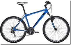 So our third (winning) idea was to buy bikes in San Jose and then sell them at the end of our trip. Baller, eh? I’d heard of people doing this with a motorcycle or a motorhome, so why not a bike? It felt like an elegant solution.
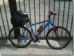
I looked around online and found two shops in San Jose with web sites, and one of the two replied to my emails. PuroMTB is a well-equipped shop in central San Jose, just south of the La Sabana park. We agreed to buy two Trek 3500 mountain bikes for $390 each plus taxes, and reserved our sizes with a $100 deposit per bike.
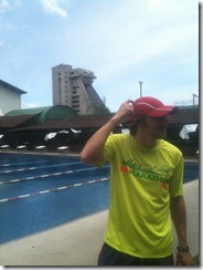 Finding PuroMTB was a big adventure. Addresses in Costa Rica tend to be written like “75 meters west and 50 meters south of the controleria.” Our big mistake was leaving my printed copy of the address and directions at the hostel. My best recollection was 200m and 75m south & west, but I couldn’t remember which was which. I’d forgotten the detail about it being on a dead-end street. So we asked about a dozen people on the street. Ticos are very friendly and helpful, but if they aren’t sure where something is then they will give you their best guess. We ran around for 90 minutes looking for the shop!
At one point we went inside a tennis club and the concierge was nice enough to call the bike shop for us. But nobody answered. Luckily(?) I was able to use their WiFi to look up the directions, so we knew they were at 75m south and 50m west, on a “calle sin salida.” To the right you can see Tahoma wondering “now where did that Controleria go.” The Controleria is the semi-trangular block concrete peaking out over the pool.
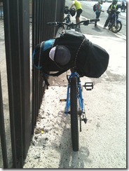
Finally finding PuroMTB felt like that moment when a computer program you’re writing finally does *exactly* what you wanted it to do. Like winning. Like, “wow, we are so smart! We figured this out!!” Even when it took you much more time than it should have taken. ![]() Anthony and his team were finishing up the assembly of our bikes, so we roamed around the shop and bought accessories. The luggage racks were clutch, and they had exactly two left in stock. Win. Again.
Anthony and his team were finishing up the assembly of our bikes, so we roamed around the shop and bought accessories. The luggage racks were clutch, and they had exactly two left in stock. Win. Again.
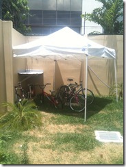
I enjoyed PuroMTB’s little courtyard, where a few bikes appeared to be resting from the mid-day sununder an EZ-Up canopy.
Of course, nothing should every be this easy, so just before we attempted to pay the remainder of what we owed, there was a power outage. So their credit card machine was offline. We each had brought more than enough cash to cover the $300/bike but we had hoped to save that cash to use in rural areas and on small expenses. Well, we had each brought the money to Costa Rica. Only Tahoma had thought to bring his to the bike shop. I had left mine at the hostel. Win. So he paid for his, I left my driver’s license and credit card as a “deposit,” we rode back to the hostel, packed up our bags, and Tahoma then found us some lunch while I rode to the shop & back again to pay for my bike.
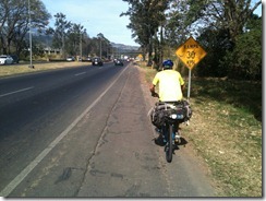 By 2:45pm we were finally riding away from the hostel and into San Jose’s rush hour traffic. The gentle grade out of San Joe to the east was a bit more of a slog than we had expected. The heavy traffic and exhaust ad road construction and very un-Seattle heat and sunshine didn’t help. Our unplanned 90-minute run didn’t help either!
We stopped for more water in the town of Cartago, and very soon after that we were on a quiet country road that led to the beautiful Orosi Valley
Day 1 Summary: 22 miles of riding (after leaving the hostel). Roughly 2hrs of riding time.
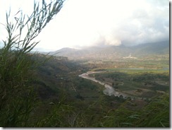
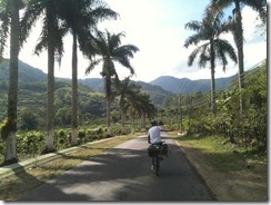
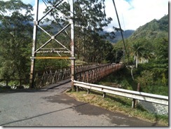
The second day was probably the toughest and hilliest and wettest, and may have included the most wrong turns. We got an early start out of Orosi and enjoyed the first 10-15 miles in the beautiful Orosi Valley. We forgot to take a shortcut out of town that would have crossed the Orosi River on an old footbridge and saved us a few miles, but we didn’t really care because the roads were gorgeous and empty.
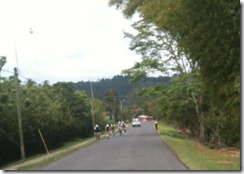 The Thursday before Easter is a big holiday in Costa Rica, and we saw at least a hundred people out riding their bicycles on these beautiful, quiet country roads. We saw plenty of people on bikes all over Costa Rica and Panama, but they were almost all commuting or running errands. Here in the Orosi Valley we saw groups of cycling enthusiasts out on training rides, often on a mix of road, TT and mountain bikes. We saw at least four or five groups of eight or ten riders, one of which looked like a hard "drop ride” with 25-30 riders!
There was only one road to follow for at least 6-8 miles, but eventually we hit an unmarked Y-intersection. We used a crude printed map and whatever Google Maps were cached on my mobile phone to correctly pick the left fork. Then we were so proud of our cunning that at the next intersection we quickly turned right and just knew we were correct because we’re just that good. We weren’t. We climbed up through a small village. I saw a few signs that told me this village was off our route, so we asked a kid and he confirmed that we were off course, and we reluctantly descended back to the valley.
We reached a bigger Y intersection that was actually marked with a sign (yay!!), and the name of the town was familiar to us (yay!!). But this time we had the humility to pull out our crude maps again and determine that Tuccurique was also not on our planned route. So we continued. The next two right turn options were unmarked, so we kept going until we found a marked left turn. We pulled out the maps yet again and deduces that left would lead to some ruins and straight led up a giant hill to Paraiso, so apparently we needed one of the unmarked turns. Turn around again. At least this time the extra miles had been flat.
After doubling back to the unmarked road, which was route 235, it was time for the real work of the day to begin. The road started to tip gently upward out of the Orosi Valley! The ride on route 235 from the valley up to highway 10 was a tough climb that probably gained 1200 feet in 3-5 miles. Sure I’ve climbed much bigger & steeper, but this was on mountain bikes with 12kg backpacks and tropical heat, sunshine & humidity.
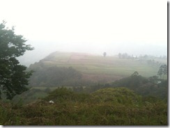 Once we were on highway ten, the slopes were less fierce and the road was a bit wider, but we had a bit more traffic to contend with, too. We had a mix of mist and rain until lunchtime, which was actually quite pleasant with all of the climbing. We weren’t cold until we stopped to eat.
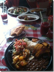 We had a very hearty lunch in the mountain town of Turrialba. Most businesses were closed for Semana Santa, but Tahoma spotted a place that was open. We each had a casado – or “house special – a plate lunch with rice and beans and plantains and salad and a meat entrée and a juice drink – plus we each ordered an empanada on the side. This full table of food cost about $14.
After lunch, we were very slow to get rolling again. The rain had briefly stopped and we had changed into dry clothes, but before we finished eating the rain had started up again. We hoped to start with dry conditions and killed time chatting with the folks at the table next to us. They gave us some advice on which routes to take, in a pleasant mix of my mediocre Spanish and their mediocre English. Eventually we decided to just start riding in the rain. It was comical at times to have water splashing up at us from the roads, but at least it was warm. The road out of town was a false-flat downhill and we were able to motor-pace with the cars for two miles. It was terrific to get a fast start to the afternoon! But we knew things would slow down. Another 1200ft climb loomed in the afternoon.
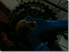 This day’s hero was the “Mega Range” cog that the good folks at Trek decided to spec on the 3500. I forget how many teeth this baby has, but that least shift from the second-biggest cog to the biggest is a *huge* change in gear ratio and it really comes in handy when you are carrying a backpack through a mountain range.
Once we finally reached the top of the afternoon climb, the final 8-10 miles into Siquerres were easy. There was a fun twisty decent and then a long, straight rollout that brought us straight over Hwy 32 (the next day’s ride) and into Siquerres. We were pleasantly surprised to get there around 3pm and briefly considered riding on to Limon that day. Limon was another 35 miles away, but it was *on the coast.* Neither town is much of a tourist destination, but we eventually decided we didn’t want to be hunting for lodging in Limon at/after dark. So we started asking around for directions to the one place that we had heard about in Siquerres: Chito’s. Here is what the Lonely Planet has to say about lodging in Siquerres:
XXXXXXXXXXXXXxxxxxxxxxxxx
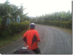 After our experience with the bike shop, we were skeptical when the first dude we asked seemed to know “Chito’s” and offered to show us the way. We followed his motorcycle around a few corners and then he told us to just cross these railroad tracks, continue straight ahead, and keep following the road until it ended. Which route was “straight” became unclear and the left fork was heading into a rather sketchy-looking area, so we asked another guy for directions. Again he seemed to know about this “Chito’s” and he directed us back to the other fork, and said it was like another 2km before the road ended. So we set out again, cautiously optimistic that we would find it. We passed some kind of tourism center whose sign was partially obscured by trees, then the road turned to gravel and we were in a banana plantation. Tahoma wanted to turn around but I insisted that we had to be getting close. Finally he suggested that we at least double back to the tourism center and ask for directions again.
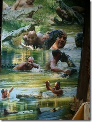
We doubled back to the tourism center and it turned out to the “tourism center of Chito and Pocho.” So we had ridden right past it. Wow. Chito and Pocho are worth their own blog post, so I will just give you this teaser for now:
Day Two Summary: 60 miles and a whole lot of climbing in maybe 5 hours of riding?
Our third day was out most ambitious mileage day, especially after the previous day’s hills, but these miles would be quite flat. We left Siquerres a bit later than planned, thanks for our adventures with Chito, but once we got onto Hwy 32 we started making excellent time. The shoulder was decent, the pavement was very good, traffic wasn’t all that bad, and there was nothing much steeper than a false flat and never for more than a quarter mile. We cruised along, stopping occasionally to stretch a little. We never saw sunshine – it was always overcast – but didn’t get more than a little drizzle until Tahoma tempted fate a few miles outside of Limon: “I bet we’re gonna get up over that next hill and it will be nothing but blue skies for the rest of the day!”
We got up over that next hill and the sky just opened up into a tremendous downpour. Comically heavy rain. Big fat raindrops hitting you in the face. Rain quickly puddling a few inches deep on the roads, and splashing up all over you. I clipped a red blinky light to my backpack for safety/visibility, then just took over a lane and dropped the hammer for these final few miles. I kept up with the cars pretty well and just rolled all the way into beautiful Limon.
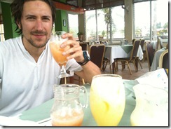
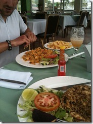 We found the only restaurant with a view of the water and it turned out to be one of the fancier places in town. Casados with a white tablecloth! But the juices were *fantastic* and we each wolfed down a prodigious amount of food. “The casado comes with a salad or fries, eh? Can I have both?”
Limon is sort of a grungy port town. Not in a charming/American/gentrifying way. Just kind of grungy. Tourists don’t really stop there. At least that’s what the guidebooks say, and we didn’t see much to contradict that. Some street people offered to watch our bikes for us while we ate lunch, which made us a bit uncomfortable as their social manner wasn’t terribly polished. But we locked the bikes up outside the window of the restaurant and the two dudes just hung out there while we ate. We gave them each two bucks for their time and they seemed grateful.
Our day got a lot more photogenic after leaving Limon – the scenery got better and the rain stopped, so we could keep our cameras out and take lots of pictures, such as…
The remarkably small Limon airport, sandwiched between the only road and the water: 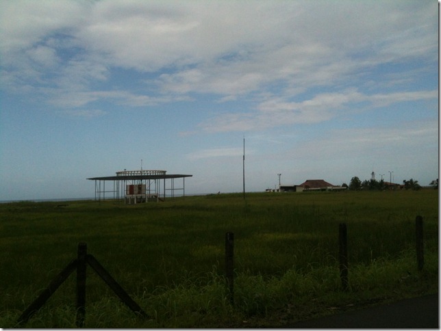
Tahoma is very happy that there is a town called “Bomba,” especially after our killer karaoke performance of La Bomba in San Jose: 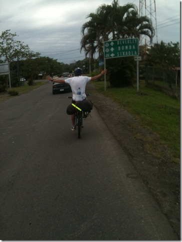
I would call this animal a “sloth” but apparently French Canadian girls call this animal a “slut.” Ask one sometime. Never. Gets. Old. Or maybe if you are lucky she will ask you, “are we going to see any sluts today?” Tee hee… 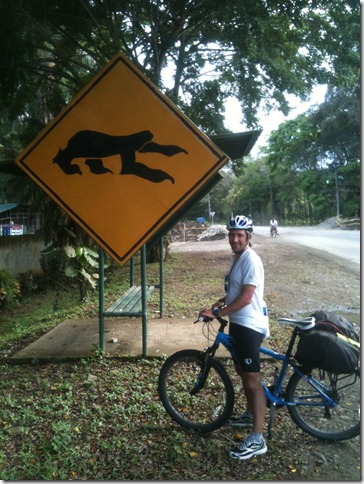
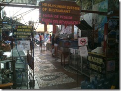 We rolled into Puerto Viejo before dark, a bit tired but eager to kick back and/or cut loose now that we were finally at the beach. The most interesting hostel that I’d read about there is called Rocking Js and it didn’t disappoint. We only stayed there the first night. I’ll say more about this place in my post on the beach towns. We arrived at 6pm on the Friday of Semana Santa and the place was *packed.* They were charging holiday rates and we paid $10/each to sleep in hammocks!
Day Three Summary: 76 miles, 6 hours of riding
After a memorable weekend in Puerto Viejo, we set out on the final leg of our bike journey on the Monday following Semana Santa. A staff member at Pagalu hostel pointed us towards a shortcut that would save us from doubling-back five miles to the main highway before proceeding south to the border crossing in Sixaloa. He suggested we ride south towards Manzaillo and go past Playa Cocles, then turn right after the second bridge, following the signs towards the town of Margarita. Margarita is on the main highway, so this would intersect with our planned route and save us 8-10 miles.
But after crossing the second bridge, we saw no signs for Margarita and we didn’t even see anything that looked like a road. I saw one or two gravel driveways that *might* have been the road, but we weren’t sure enough to turn around. Luckily we happened to catch up to a friendly fellow on an old cruiser bike who we now lovingly refer to as “Rasta Mon.” The conversation went something like this:
Gringos: did we miss the road to Margarita?
Rasta Mon: Yeah, Brah. It was back there before the bridge, Brah.
Rasta Mon: But there is another way, Brah. You don’t have to turn around, Brah.
Gringos: Awesome. Where is it?
Rasta Mon: Keep going down this road, Brah. Go a few more miles, Brah. Look for Maria’s and the pink house, Brah. Follow the signs for the butterly farm, Brah.
Gringos: Wow, thanks! So Maria’s, pink house, butterfly farm? Is it just the one turn?
Rasta Mon: Yeah, Brah. But be careful. Once you make the turn, any time you have a choice, go right, brah. If you go left, you might go into Panama and then they’ll want to see your papers, Brah. And you won’t have them, Brah. You have to cross at Sixaola, Brah. So remember, right, right, right. On the way back, left, left, left.
I swear he called us “brah” at least thirty times in a two-minute conversation. And I’ll never forget the way he said “right, right, right” and “left, left, left.”
I wish we had stopped to take a photo with Rasta Mon.
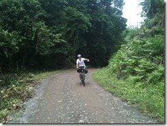
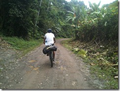
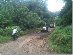
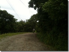
We somehow found the gravel road near the pink building and the butterfly farm, and it was gnarly! Hilly, muddy, awesome!!
There really weren’t any turns. A few driveways, and exactly one road that went off to the left. But we made sure to not turn left! After plenty of mellow climbing and descending and mud … and one short not-so-mellow climb … we popped out of the woods and onto the main highway again. Easy!
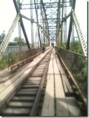
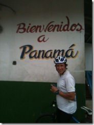
From there it was maybe 15 miles to the border at Sixaola. We were surprised at the amount of foot traffic over the border. There must be a large population that commutes over the border daily for work or shopping. Very few of the people that we saw approaching the bridge or on the bridge were stopping at the passport control booth, so the locals must have a visa that lets them pass back and forth freely.
After a few wrong turns, we eventually found our way into Changuinola for lunch. Afterwards a friendly teenager on a racing bike showed us how to get onto the road to Almirante. We thought it would just be one well-marked turn but intead it was three or four, and none of them were marked! Once again, the kindness of strangers helped us through.
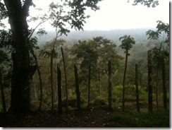 The road from Changuinola to Almirante was crazy-hilly. Not as consistently up as our day in the Turrialba mountains, but equally relentless! It was just roller after roller after roller after roller. You could maintain some momentum into the bottom of each, but it was never enough to carry rider and bike and backpack to the top. We labored through that forested road in a light misty rain for about an hour before reaching the summit.
Luckily a lot of climbing is usually followed by a lot of descending, so the final 8km into Almirante really flew by. We rolled into town around quarter to six, as a bunch of schoolkids in uniforms were milling around. We got reasonably close to the water taxi docks before a few locals who saw that we were clearly Gringo Town advised us that we were heading in the wrong direction. One guy offered to escort us to the dock on his bicycle (I’m sure he gets a kickback) and we gladly accepted. The folks at the dock said that the last boat was at 6pm, so we were glad to have had the assistance. We were out of US Dollars (the currency in Panama) but had plenty of Costa Rican colones. Sadly they didn’t accept colones. So the same local dude escorted me to the ATM. He got a nice tip from us!
I wish I had better photos of the water taxi. I don’t have any worth posting. The boat held about twenty tourists and they jammed our bicycle in the back area. The boat probably left around 6:15 or 6:20, but I would certainly plan to arrive no later than 5:45 if you ever go there, just in case the 6pm cut-off is real.
Day Four Summary: 60ish miles, 4hrs of riding
The bikes were fun to have in Bocas del Toro, but that will be covered in another post. We sold them to the owner of our hostel for $250/each, which was a pretty good deal for all parties. In the end, we spent $150 plus taxes and accessories to ride the bikes for ten days, and he got some awesome almost-new bikes for a healthy discount.
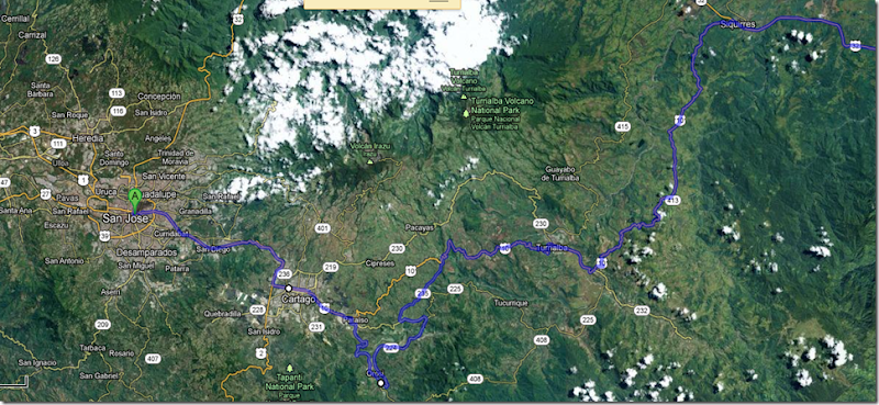
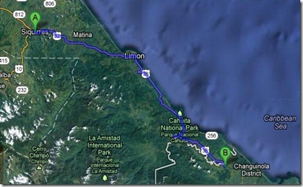
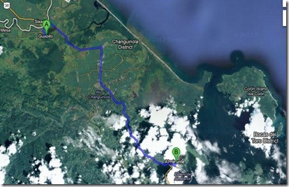
Route Overview:
There were surprisingly few turns on our route, and if you knew the name of the next town you wanted to reach then you were (mostly) okay just following the signs. Except for those times when you weren’t. Heh…
- Highway 2 east out of San Jose towards Cartago
- Just before Cartago, bear left onto Hwy 10
- After Cartago, you will be back on Hwy 10 to Paraiso
- In Paraiso, turn right towards Orosi. Marked.
- Optional footbridge shortcut across the river in Orosi, then turn left.
- Right onto Hwy 235 (unmarked). Stay left until you get *past* the turn-off for Tuccurique. If you get to the turn-off for the ruins then you’ve gone too far.
- 235 T’s into Hwy 10. Turn right.
- In Turrialba, follow the main flow of traffic.
- Just before Siquerres, ramp onto Hwy 32.
- In Limon, just a few blocks before you hit the Caribbean Sea, turn right onto Hwy 36 towards Puerto Viejo and Cahuita.
- After passing Cahuita and the park, turn left onto the road to Puerto Viejo and Manzanillo. It is another 3-5 miles from here to Puerto Viejo.
- To get to Sixaloa, you can double-back to the main highway or you can ride south from PV and then try to find the Margarita road or Rasta Mon’s road (“right, right, right”), then turn left on the highway after the hilly gravel awesomeness.
- Immediately after crossing the border into Guabito, try to turn left. Don’t ride out of town without taking that left. You’ll be in banana plantations forever. At least you won’t starve to death with all those bananas around!
- After downtown Changuinola, you’ll eventually make a right at a T intersection and then a left pretty soon, and then maybe another right… and possibly more turns here. Good luck with this part. We had a guide!
- Once you’re over that bridge, the route to Almirante is easy to follow but hard to power through. Enjoy those hills!!
- In Almirante, you may need to ask around to find the water taxis. They will charge you something between $2 and $8 per person+bike, and the last boat might officially depart at 6 but actually depart at 6:30.
Lodging Summary:
San Jose: Hostel Shakti. Dorm beds but we were the only occupants. About $15/person.
Orosi: hostel. dorm beds. $9/night. No internet. Warm showers.
Siquerres: Chito y Pocho’s. $50 for a private room without A/C. It would have been an extra $5 for a room with A/C, but we didn’t need it. Our room has two single bunk beds and a double bed.
Puerto Viejo: We stayed at two places: Rockin Js (hammocks, $10/person/nt during Semana Santa, would be $7 at other times) and Pagalu ($26/nt for a private room with a queen/double bed)
Bocas del Toro: HosteLuego. $35/nt for a private room w a double/queen bed and A/C. Includes free pancakes and coffee in the morning.
Panama City: Luna’s Castle. $13/nt for a dorm bed, includes free pancakes, coffee and bananas in the morning.



No comments:
Post a Comment